17 May 2023, ♣ SF Presidio: Tunnel Tops

17. May 2023, SF Presidio: Tunnel Tops

For The Presidio of San Francisco, see 17.5.2023.

Presidio Tunnel Tops – … on top of the tunneled portions of Doyle Drive … The park contains several meadows and walking trails, along with viewpoints for major landmarks … The budget for the park is $100 million, funded with public funds from the Presidio Trust along with private contributions … opened for public use on July 17, 2022 …

8, 16-17 May 2023, ♣ Φ The Presidio of San Francisco

8., 16.-17. May 2023, The Presidio of San Francisco

https://en.wikipedia.org/wiki/Presidio_of_San_Francisco: … (originally, El Presidio Real de San Francisco …) … a park and former U.S. Army post on the northern tip of the San Francisco Peninsula … part of the Golden Gate National Recreation Area … a fortified location since … 1776, when New Spain established the presidio to gain a foothold in Alta California … passed to Mexico in 1820 … to the United States in 1848 … As part of a 1989 military reduction program …, Congress voted to end the Presidio’s status as an active military installation of the U.S. Army … 1994, it was transferred to the National Park Service, ending 219 years of military use and beginning its next phase of mixed commercial and public use … In a first-of-its-kind structure, Congress mandated that the Presidio Trust make the Presidio financially self-sufficient by 2013. The Presidio achieved the goal in 2005 … The park has … wooded areas, hills, and scenic vistas overlooking the Golden Gate Bridge, San Francisco Bay, and the Pacific Ocean … recognized as a California Historical Landmark in 1933 … as a National Historic Landmark in 1962 … Beginning in the 1890s, the Presidio was home to the Letterman Army Medical Center (LAMC), named in 1911 for Jonathan Letterman, the medical director of the Civil War-era Army of the Potomac …

Preservation – After a hard-fought battle, the Presidio averted being sold at auction and came under the management of the Presidio Trust, a U.S. government corporation established … in 1996. The Presidio Trust … has jurisdiction over the interior 80 percent of the Presidio, including nearly all of its historic structures. The National Park Service manages coastal areas … The Presidio Trust Act calls for “preservation of the cultural and historic integrity of the Presidio for public use.” The Act also requires that the Presidio Trust be financially self-sufficient … These imperatives have resulted in numerous conflicts between the need to maximize income by leasing historic buildings, and permitting public use despite most structures being rented privately. Further differences … from the divergent needs of preserving the integrity of the National Historic Landmark District in the face of new construction, competing pressures for natural habitat restoration …  inventory of approximately 800 buildings, many of them historical … Sections of the Letterman Army Hospital were preserved by the Thoreau Center for Sustainability … The Trust entered a major agreement with Lucasfilm to build a new facility called the Letterman Digital Arts Center (LDAC), which is now Lucasfilm’s corporate headquarters. The site replaced portions of what was the Letterman Hospital. George Lucas won the development rights for 15 acres (6.1 ha) of the Presidio, in June 1999, after beating out a number of rival plans …


Presidio Cycling advance – Signage: „The Presidio Trust is piloting an innovative type of bike facility called Advisory Bike Lanes … where roadway width is limited and traffic volumes are low … When two cars traveling in opposite directions approach each other, one vehicle merges into the bike lane to pass … When cyclists are in the bike lane, the motorists must yield to the cyclists before entering the bike lane …”Presidio Cycling advance – Signage: „The Presidio Trust is piloting an innovative type of bike facility called Advisory Bike Lanes … where roadway width is limited and traffic volumes are low … When two cars traveling in opposite directions approach each other, one vehicle merges into the bike lane to pass … When cyclists are in the bike lane, the motorists must yield to the cyclists before entering the bike lane …”

15-16 May 2023, Tomales Bay (Marin County, CA)

15-16 May 2023, Tomales Bay (Marin County, California)

https://en.wikipedia.org/wiki/Tomales_Bay: … a long, narrow inlet of the Pacific Ocean … approximately 15 mi (24 km) long …, effectively separating the Point Reyes Peninsula from the mainland of Marin County … On its northern end, it opens out onto Bodega Bay, which shelters it from the direct current of the Pacific … The bay is formed along a submerged portion of the San Andreas Fault … Oyster farming is a major industry on the bay … territory of the Coast Miwok … Early 19th-century settlements constituted the southernmost Russian colony in North America … The Ramsar Convention, signed in 1971, listed Tomales Bay as a wetland of international importance. The Giacomini Wetland Restoration Project, completed in 2008, returned to wetland several hundred acres at the south end of the bay that had been drained for grazing during the 1940s.

16 May 2023, Point Reyes (Marin County, CA)

16 May 2023, Point Reyes (Marin County, CA)

Dayhike:

  • (Drive on Limantour Rd. / Muddy Hollow Rd)
  • Starting from trailhead: Muddy Hollow Trail to the South -> Limantour Beach
  • Along Limantour Beach, eastwards
  • Coast Trail to the North, up to Muddy Hollow Rd (near Pt. Reyes Hostel)
  • Proceeding to trailhead.

Links:

Sign: “Measure for sea level. This pole marks projected sea level and storm surge – showing how rising waters could affect this coastal estuary system … projected sea level in 2100 … elevation of bridge deck …“

Point Reyes, https://en.wikipedia.org/wiki/Point_Reyes: … Spanish: Punto de los Reyes … a prominent cape … on the Pacific coast … in Marin County … The term is often applied to the Point Reyes Peninsula, the region bounded by Tomales Bay on the northeast and Bolinas Lagoon on the southeast. The headland is protected as part of Point Reyes National Seashore … The cape protects Drakes Bay on its southern side. The headland is largely drained by Drakes Estero … The contemporary inhabitants of the Point Reyes area at the time of European arrival were the Coast Miwok … Four towns comprise the communities of Point Reyes: Bolinas, Olema, Inverness, and Point Reyes Station. For centuries, Bolinas’ remote lagoon made it the perfect secret harbor …

Point Reyes National Seashore / Historic Landscapes of Point Reyes, www.nps.gov/pore/learn/historyculture/places_historiclandscapes.htm (18.3.23): The … peninsula is remarkably covered with numerous layers of human activity that have left sometimes overt, other times subtle changes on the landscape … identified twelve historic cultural landscapes within its boundaries and the north district of Golden Gate National Recreation Area administered by Point Reyes … The dairy and cattle ranches … represent the single largest cultural landscape …

13-15 May 2023, California Coast: Russian River, Ft. Ross, Salt Pt., Sea Ranch (Sonoma County, CA)

13-15 May 2023, California Coast: Russian River, Ft. Ross, Salt Pt., Sea Ranch (Sonoma County, CA)

[From South to North:]

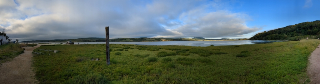
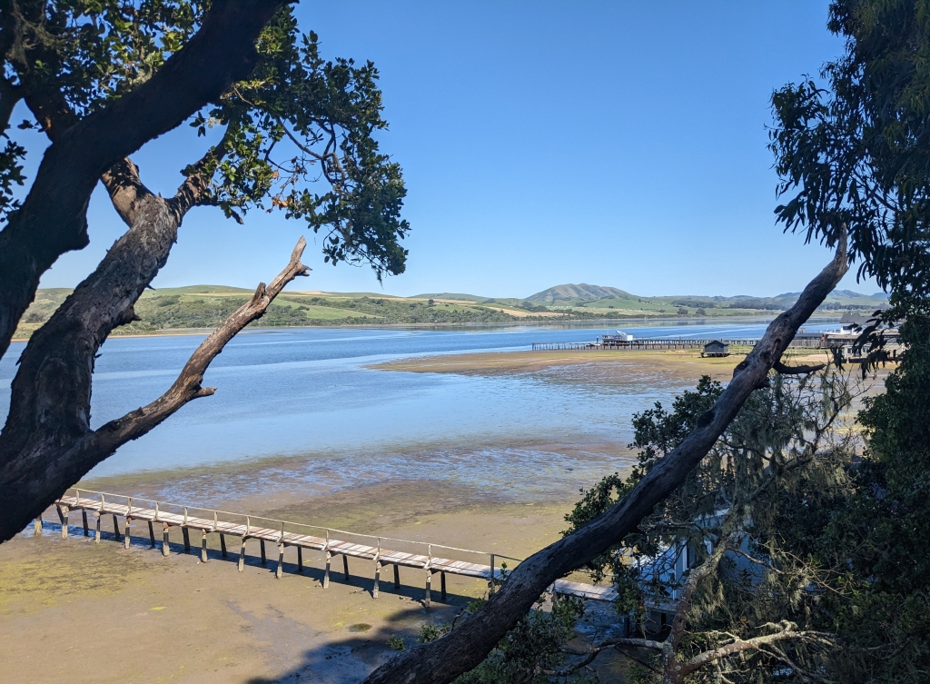
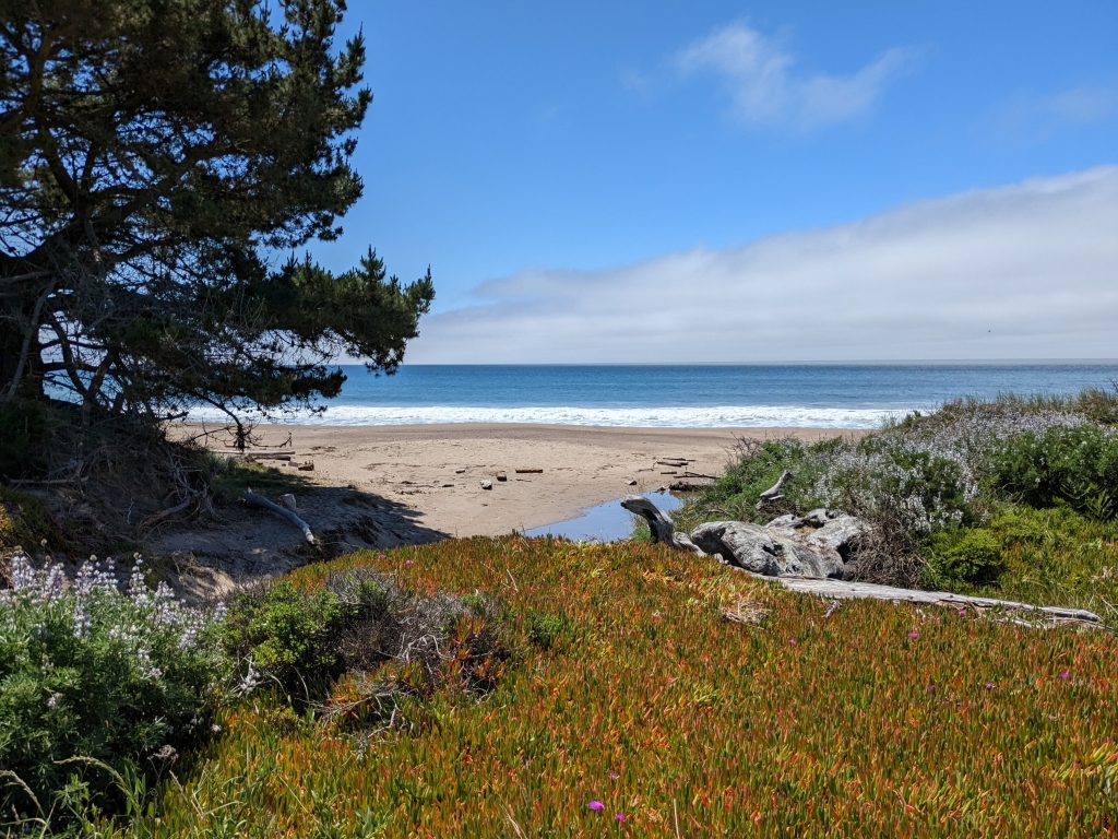
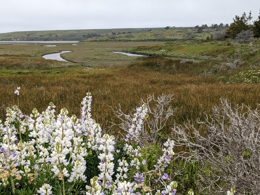
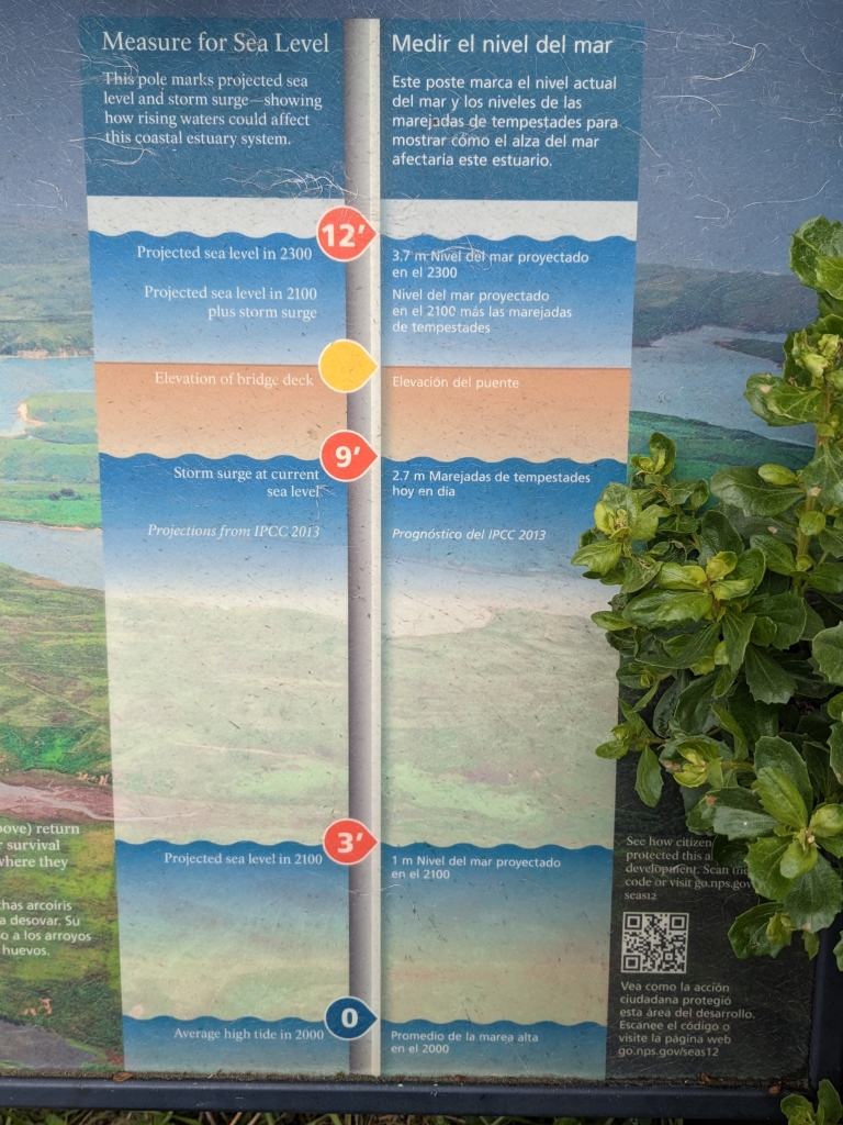
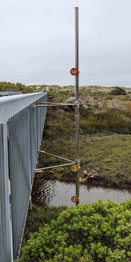
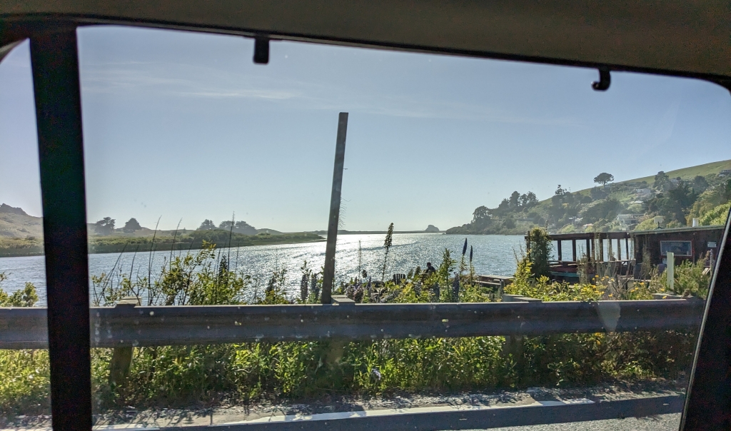
Russian River, https://en.wikipedia.org/wiki/Russian_River_(California) (18.3.2023): … the second-largest river (after the Sacramento River) flowing through the nine-county Greater San Francisco Bay Area … The … estuary is recognized for protection by the California Bays and Estuaries Policy …

Cf.: https://rfehr.eu/new-places/hydrogeography-hydrogeografie/pacific-ocean-pazifik/

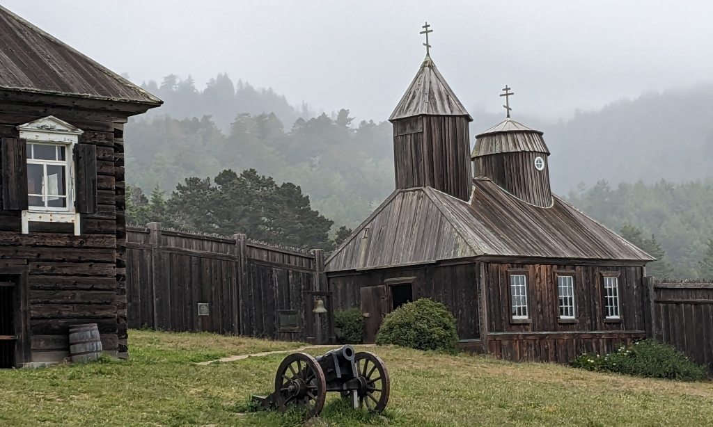
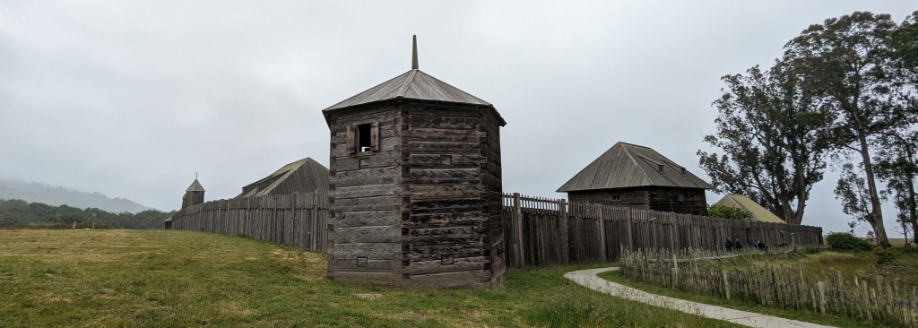
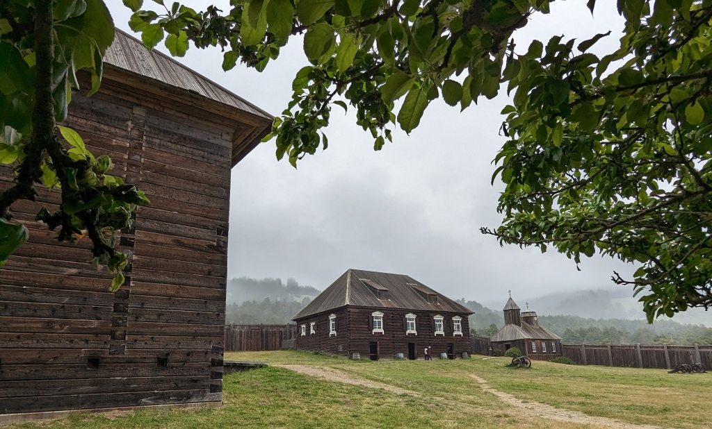
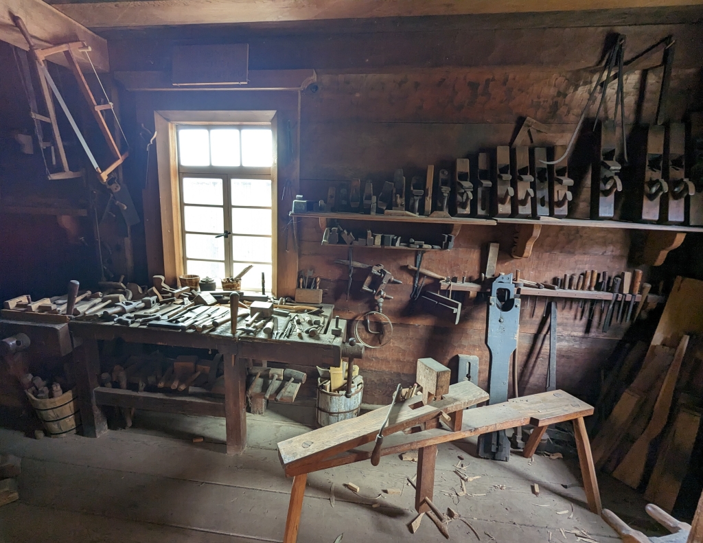
Fort Ross, https://de.wikipedia.org/wiki/Fort_Ross (18.3.2023): … 1812 bis 1841 eine Niederlassung der Russisch-Amerikanischen Handelskompagnie … im heutigen Sonoma County … südlichster befestigter Außenposten Russisch-Amerikas … Stützpunkt für die Pelztierjagd … Versorgung von russischen Handelsniederlassungen in Alaska mit Lebensmitteln … Mit dem Rückgang der Seeotterbestände und unzureichenden Erfolgen in der landwirtschaftlichen Nutzung … seit den 1830er Jahren zunehmend … unwirtschaftlich … – … 1812 begann Iwan Kuskow mit 25 Russen … und rund achtzig Ureinwohnern Alaskas … mit dem Bau des Forts. In der Konstruktion folgten die russischen Handwerker dem Vorbild der traditionellen Holzgebäude Sibiriens …

Cf. 4.9.2008, https://rfehr.eu/2008/09/15/28-aug-15-sep-2008-usa-2/

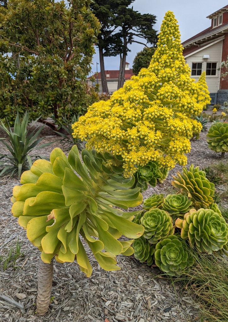
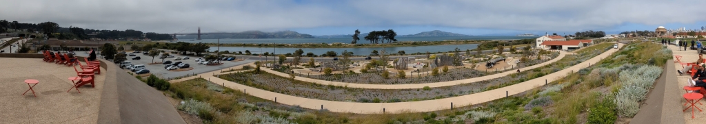
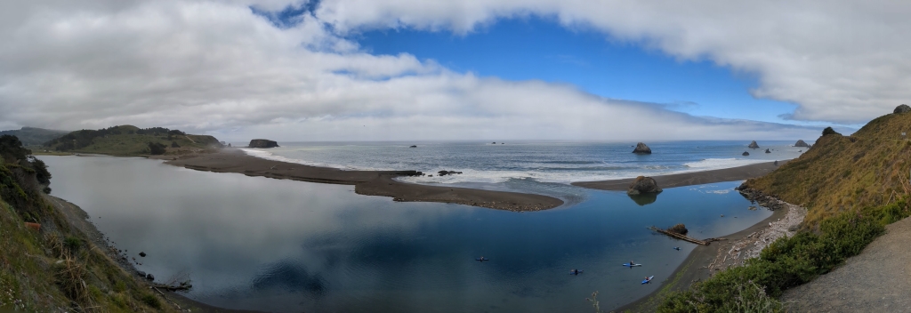
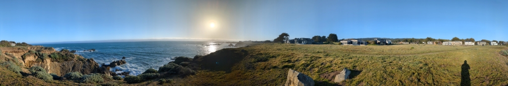
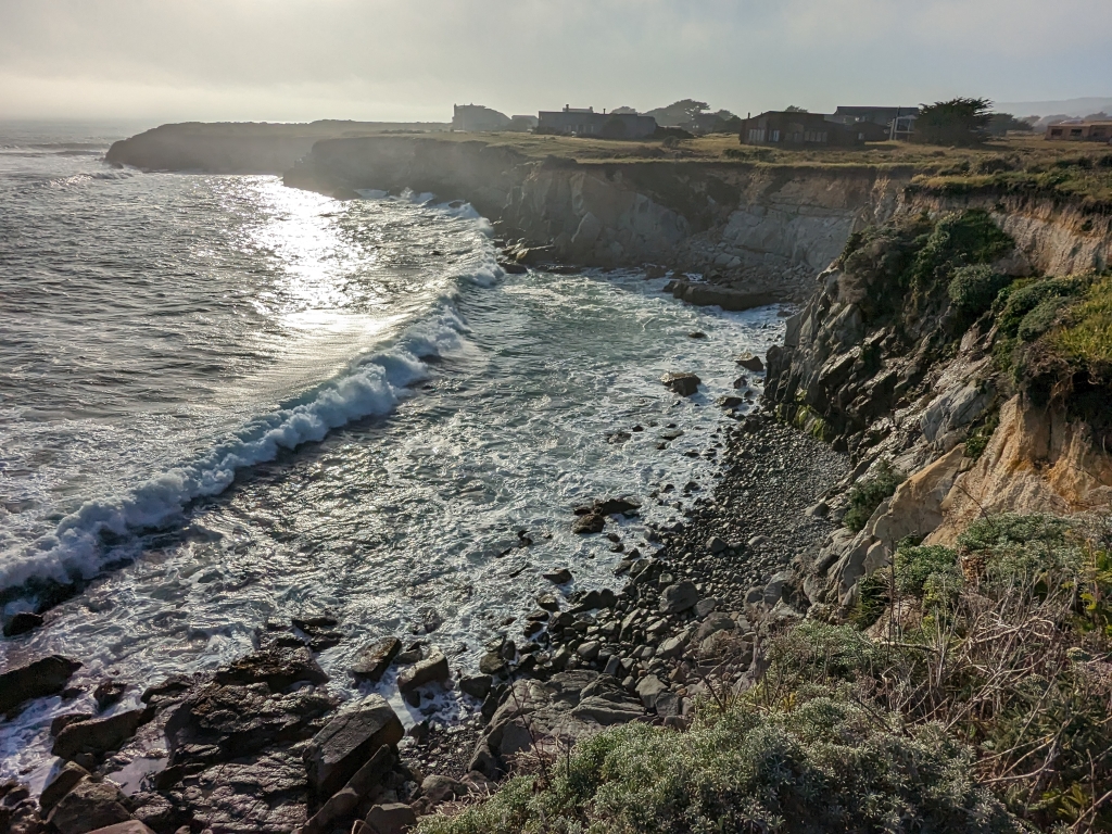
Salt Point (State Park), https://en.wikipedia.org/wiki/Salt_Point_State_Park (18.3.2023): … in Sonoma County … a rough rocky coastline … The constant impact of the waves forms the rocks into many different shapes … The native Kashaya Pomo collected salt from this area … They used abalone chisels to scrape the salt off the rocks … The eyebolts used to anchor ships down are still visible at Gerstle cove … sandstone and wood were loaded onto cargo ships … at an elevation of about … 168 m … within Salt Point State Park is a pygmy forest including the Mendocino cypress … The reason these trees do not attain their normal height is due to the highly acidic soils with minimal nutrients and a hardpan layer close to the surface … The rocks of Salt Point are sedimentary, mainly sandstone … The rocks at the north end of the park’s coast are younger than the rocks at the southern end. Salt Point is named for the tafoni where the ocean water crystallizes in the honeycomb like crevices. This tafoni is caused when the salt crystals interact with the sandstone making parts of the sandstone harden while other parts soften …

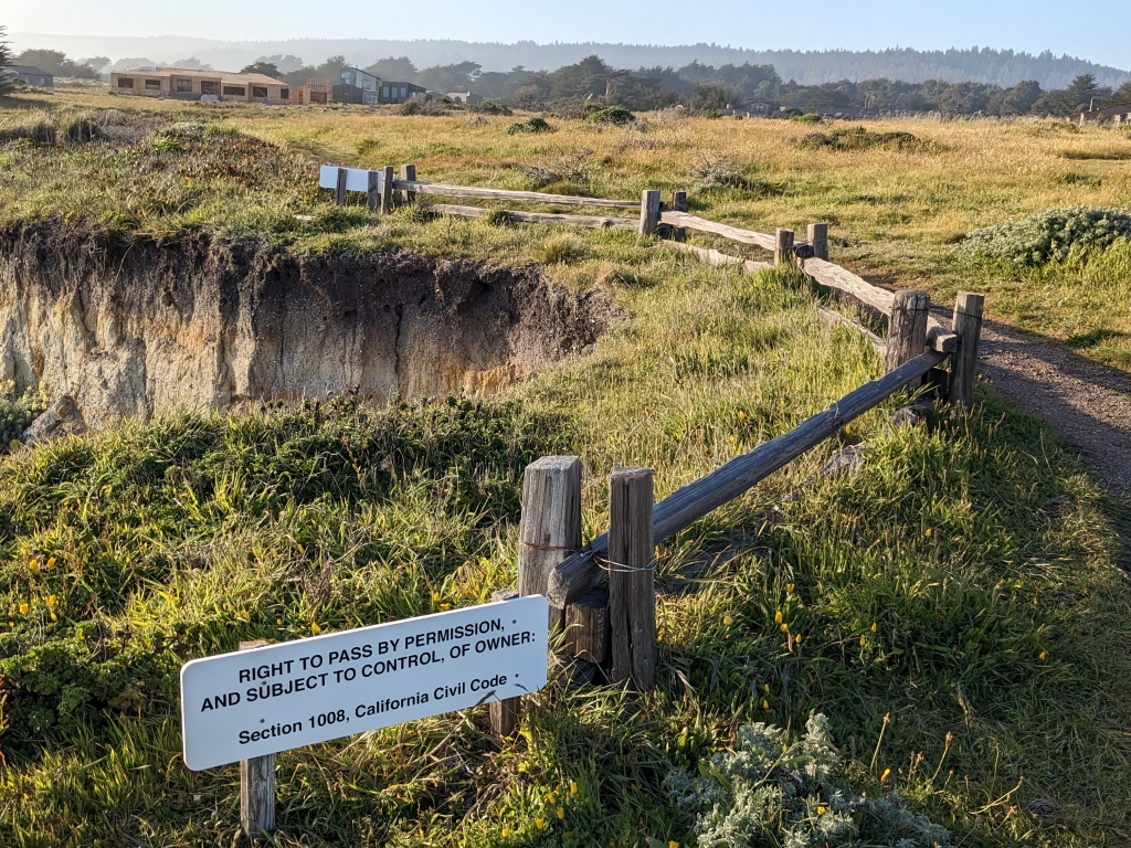
Sea Ranch, https://en.wikipedia.org/wiki/Sea_Ranch,_California (25.6.2023): … community in Sonoma County, California … that was developed as planned community beginning in the 1960s … known for its distinctive timber-frame structures designed by several noted American architects … The community’s development played a role in the establishment of the California Coastal Commission … A progressive residential community was envisioned that would be built in a way that was not only in tune with nature, but driven by nature … The building typology … draws on the local agricultural buildings for inspiration … The majority of the 1800 or so homes are smaller second homes, though there are about 300 full-time residents … The buildings could be considered a hybrid of modern and vernacular architecture, also known as the “Third Bay Tradition” … Landscaping … is regulated by a design manual that prohibits perimeter fences and limits non-indigenous plants to screened courtyards … Condominium One (completed in 1965) [i.e. the first unit built at Sea Ranch] was awarded the American Institute of Architects Twenty-five Year Award in 1991, and was added to The National Register of Historic Places in 2005. The Sonoma County Regional Parks Department provides coastal access from six places …

Cf. 1.9.2008, https://rfehr.eu/2008/09/15/28-aug-15-sep-2008-usa-2/

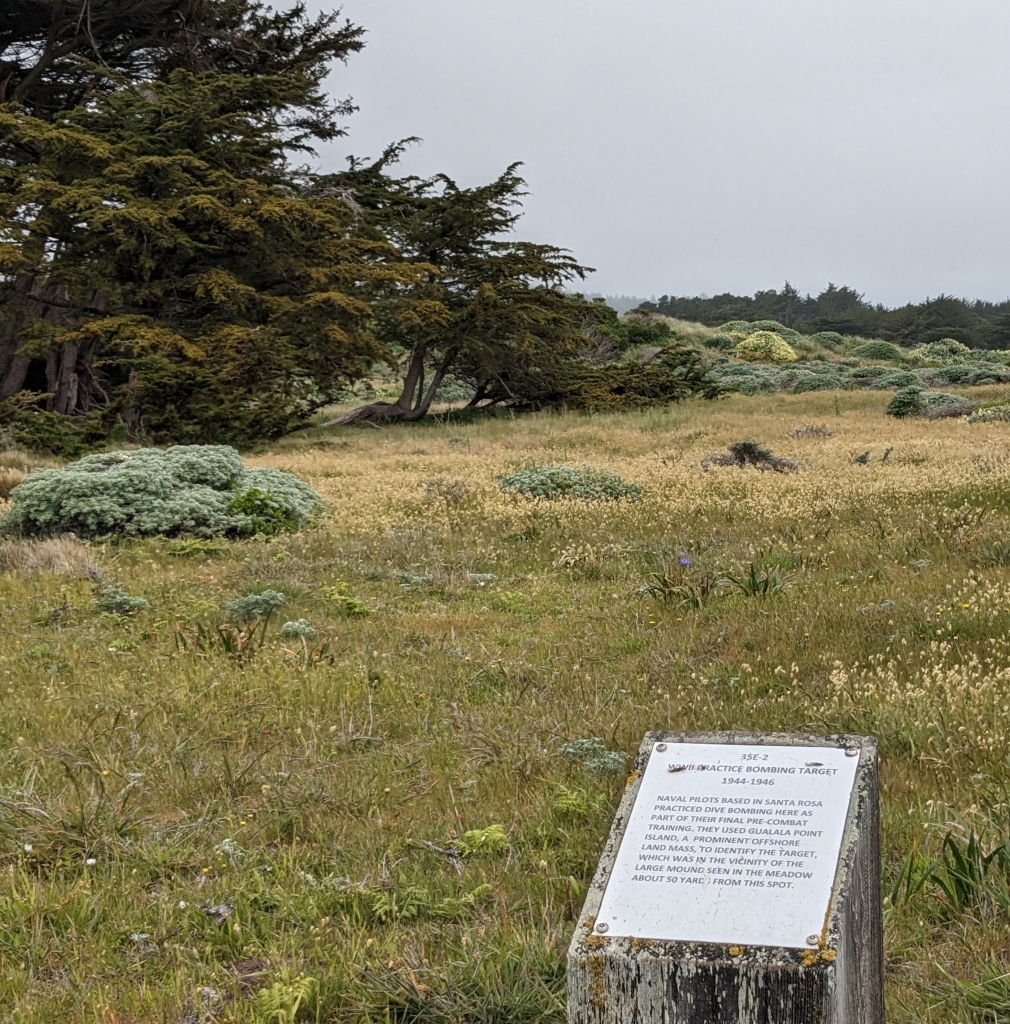
Local sign: „WW II Practice Bombing Target 1944-1946. Naval pilots based in Santa Rosa practiced dive bombing here as part of their final pre-combat training. They used Gualala Point Island, a prominent offshore land mass, to identify the target, which was in the vicinity of the large mound seen in the meadow about 50 yards from this spot.“